Roche Home Co.  Field Notes ← The Roosevelt Chapter
Downtown Phoenix · 33.456° N, 112.073° W
39 county flights · 1930 to 2024

Second &
McKinley

One Phoenix corner, photographed from the air for 94 years. Drag the slider and watch a neighborhood empty out and fill back in.

1930
Flown Jan 1930
Aerial photo of 2nd Avenue and McKinley Street, Phoenix
The corner lot
N ↑

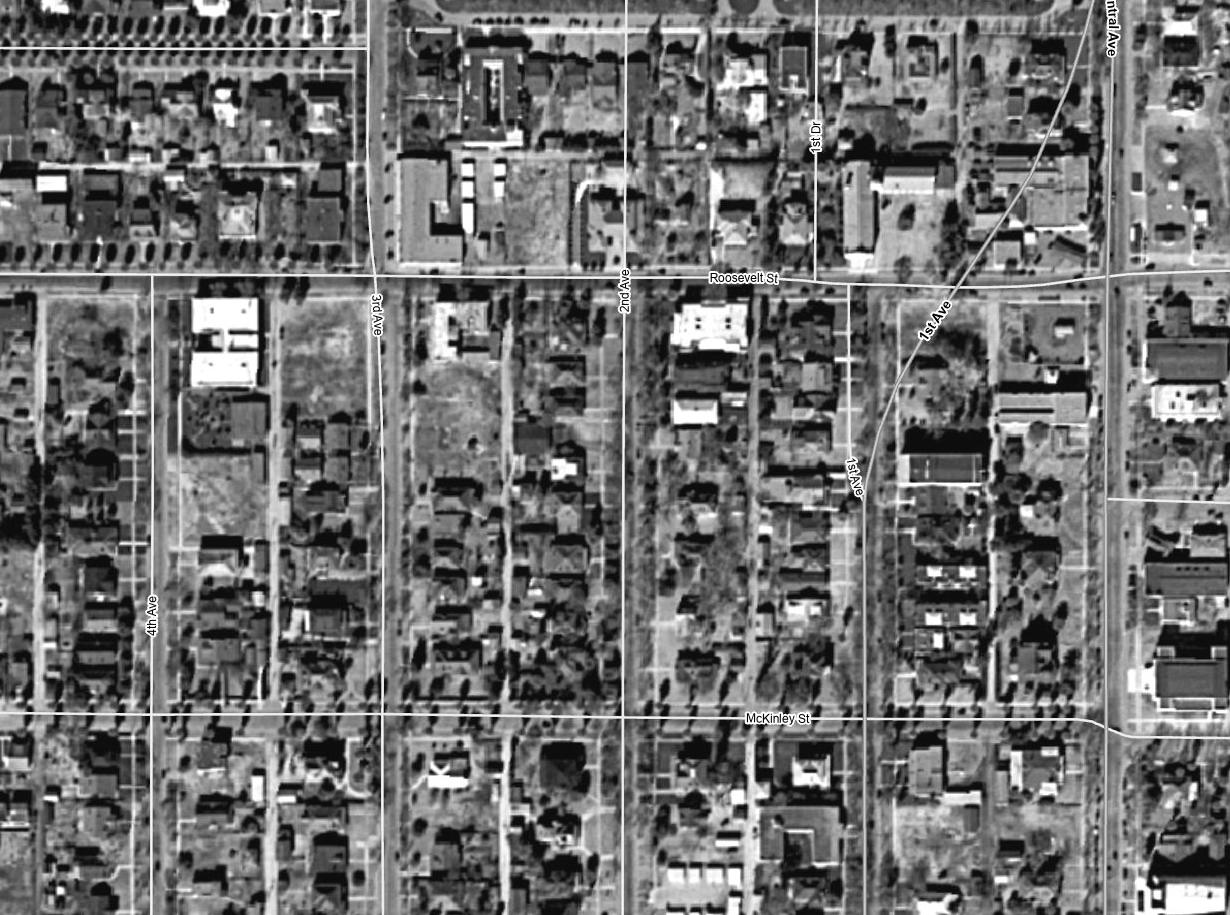
Arrow keys step one flight at a time. Street labels are the county’s current overlay; the 1930 photo sits slightly off the modern grid.

The lot at the northwest corner sat empty for more than half a century.

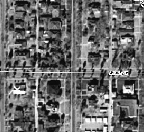
In the 1930 flight, every parcel on these blocks holds a house. By 1969 the houses on the corner of 2nd Avenue and McKinley Street are gone, and for the next 55 years the county’s cameras record the same thing there: dirt, a few palms, sometimes parked cars.

Then, in the fall of 2024, foundations. That lot is now Residences on 2nd, six townhomes. The rest of this page walks through what happened around it, flight by flight, using nothing but Maricopa County’s historical aerials and public records.

Roosevelt Historic DistrictLight rail, 1 block eastRoosevelt Row, 1 block north

The flight log

Seven moments from the 39 flights, cropped to the intersection. The yellow box marks the same corner lot in every frame.

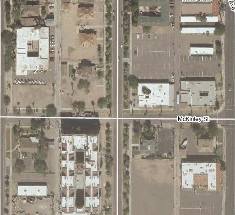
1930 aerial, houses on every lot
Flown Jan 1930
1930

A streetcar suburb, filled in

Houses on every lot, alleys down the middle of each block, and enough tree canopy that whole roofs disappear. The Roosevelt neighborhood was platted in a string of additions between 1893 and 1930, and the California bungalow is its most common house type.

The corner lot holds homes facing 2nd Avenue, same as its neighbors. Nothing about it looks special yet.
1959 aerial, houses intact with first parking lots
Flown Feb 1959
1949 – 1959

Still a neighborhood

Through the postwar flights the houses hold. A few bigger buildings show up between them, and the first striped parking appears toward Central Avenue. The corner is still residential.

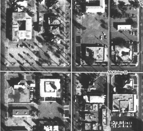
1969 aerial, the corner cleared
Flown Jan–Mar 1969
1969

The clearing

Somewhere between the 1959 and 1969 flights, the houses on the corner come down, along with several more on the surrounding blocks. The Roosevelt Action Association traces the neighborhood’s decline to the 1960s, when a proposed freeway route made banks hesitant to lend in the area and families moved north.

The corner becomes open ground. It will stay that way for 55 years.

1986 aerial, offices and surface parking
Flown 1986
1976 – 2006

The long middle: offices and parking

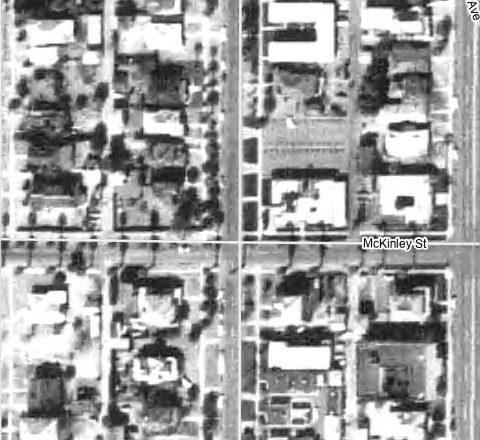
By 1976 a courtyard office building fills much of the block to the northwest, and surface parking covers the block to the northeast. By 1979 a square office building sits on the southwest corner. For the next three decades the flights barely change.

Meanwhile the paperwork shifts. The Roosevelt Historic District joins the National Register in 1983, and the city adds historic preservation overlay zoning in 1986. The empty corner keeps its palms.

2013 aerial, new apartments on the southwest corner
Flown Sep–Nov 2013
2008 – 2014

The rail arrives, and the first return

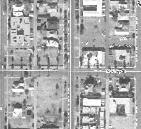
Valley Metro light rail opens in December 2008 on the Central Avenue and 1st Avenue pair, a block east of this frame’s center. A few flights later the southwest corner’s office building is cleared, and by the 2013 flight a four-story apartment building has taken its place.

The first new homes at this intersection in decades went up across the street from the corner, not on it.

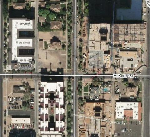
2023 aerial, towers under construction
Flown Sep–Oct 2023
2019 – 2023

Everything at once

The 1970s office building to the northwest comes down in 2019 and becomes The McKinley, 108 apartments completed in 2020. The parking lot to the northeast becomes a construction site for Saiya, a 23-story tower with 389 units. Across McKinley to the southeast, another mid-rise starts going up.

In four flights, the corner’s neighbors go from asphalt to high-rise.

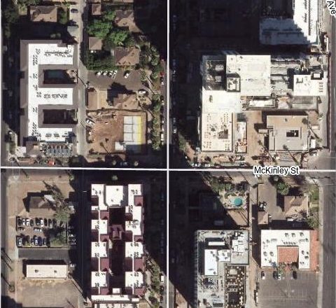
2024 aerial, foundations on the corner lot
Flown Sep–Oct 2024
2024 → today

Houses on the corner again

In the most recent flight, the corner finally shows slabs. Those foundations are Residences on 2nd: six three-story townhomes on a lot that last held houses before the moon landing.

It closes a loop. The corner started as homes on a residential street, spent two generations as leftover space between offices and parking, and is homes again, now sitting between a 23-story tower and a historic district.

1930 against 2024

Drag across the frame. Same intersection, same scale, 94 years apart.

2024 aerial of the intersection 1930 aerial of the intersection
1930 2024

Northwest: bungalows, then a 1970s office courtyard, then The McKinley apartments (2020). The corner lot sits between that building and 2nd Avenue.

Northeast: bungalows, then surface parking for roughly 50 years, then Saiya.

Southwest: bungalows, then a square office building (by 1979), then apartments (by 2013).

Southeast: the slowest to change. A few older houses near McKinley are still standing in 2024.

What one corner teaches about infill

Empty lots have a backstory

A vacant parcel in a century-old neighborhood is rarely an accident. Freeway plans, lending, zoning and parking demand all left marks here. Ninety-four years of aerials make that history visible in a few minutes.

Infill is often re-fill

The new homes on this corner are not dropping into open desert. They are going back onto ground that held homes for decades, on a street that was built for walking to a streetcar.

Context moves faster than you think

Between the 2019 and 2024 flights, this corner went from facing parking lots to facing a 23-story tower. Buyers deserve to understand what is planned around a home, not just what is standing there today.

Try it yourself

Every frame here comes from Maricopa County’s free Historical Aerial Photography viewer. Search an address, open the layer list, and switch flights from 1930 forward. It is one of the most useful tools I know for understanding a neighborhood before you buy, build, or list in it. gis.maricopa.gov

Sources

Notes